
Chisos Basin is its own day
Trails, altitude, parking, and mountain weather require enough time for the drive into the Basin and the walk back to the trailhead.
Chisos light, desert road, river canyon, and dark sky
Choose one open area: a Chisos mountain morning, reachable Ross Maxwell overlooks, or Rio Grande country. Carry water, check live road conditions, and finish the return drive before dark.
Big Bend · Terlingua / Marathon gateway
Remote West Texas desert, Chisos Basin hikes, Santa Elena Canyon, Ross Maxwell Scenic Drive, Rio Grande days, and dark-sky nights. Distances decide the trip; choose the day’s zone before adding anything extra.
Official park information →Trails, altitude, parking, and mountain weather require enough time for the drive into the Basin and the walk back to the trailhead.
NPS currently lists the road between Cottonwood and Santa Elena Canyon as closed. Keep the canyon for a future visit and use an open park area instead.
A shorter scenic-drive day, Terlingua meal, and stargazing can be the right version when the desert is too hot for ambitious hiking.
Current NPS conditions
NPS also lists Old Ore Road and Black Gap Road as closed. Conditions can change after storms, so confirm the live page before every park day rather than relying on an older itinerary.
Check Big Bend alerts and conditionsThree distinct Big Bend areas
Chisos Basin rises above the desert, Ross Maxwell crosses volcanic country, and the east side follows the Rio Grande. Current closures determine which area is practical that day.

Zone choice, heat, and night sky
Carry all needed water, check the selected road and trail, and leave ambitious hiking for a cooler morning. Stargaze near the room instead of adding a tired cross-park drive.
Zone effort
The park is too large for casual stacking. Decide whether the day is mountain hiking, west-side canyon driving, Basin scenery, or river country before adding dinner and dark-sky time.
Moderate to strenuous
Start early, carry all needed water, and choose a shorter Basin view when heat, storms, parking, or trail conditions argue against the full hike.
Easy to moderate
NPS currently lists Route 16 between Cottonwood and Santa Elena Canyon as closed. Use reachable stops such as Sotol Vista and Mule Ears only after checking the live conditions page.
Moderate
Choose a shorter Basin view when heat, storms, parking, or late arrival make the full descent and climb a poor fit.
Easy to moderate
River country and history need their own east-side drive instead of a quick stop after another zone.
First-timer choices
Choose Chisos Basin for a mountain morning, or visit reachable Ross Maxwell overlooks and return through Castolon country only as current NPS conditions allow. Do not build the day around Santa Elena until access reopens.
Chisos Basin in the morning, usually Lost Mine or a shorter Basin view when parking, storms, heat, or knees argue against a longer walk.
Visitor center, scenic overlooks, short nature walks, Terlingua time, and sunset or stars. Big Bend can still feel huge without turning the day into a trail test.
Rio Grande Village, Hot Springs Historic District, Boquillas context if open and appropriate, and east-side river country. It is too far to treat as a throwaway add-on.
A safer order for the park day
Big Bend is not the place to discover a road closure, fire restriction, full campground, or heat advisory after the long drive in. Check the NPS page, then choose the day’s zone.
Lost Mine, the Window, and desert pullouts demand water, sun protection, and a morning start. Santa Elena remains off the automatic list while Route 16 is closed.
Sotol Vista, Mule Ears, and historic ranch country can fill a west-side day without promising access to the closed Santa Elena approach. Turn around wherever current NPS guidance requires.
A west-side dinner and stars near the room beat crossing the park after a long trail. Keep enough daylight for wildlife, road damage, and slow traffic.
Common mistakes
Before you go
Big Bend is remote enough that official conditions should shape the itinerary. Check roads, permits, alerts, and safety notes before driving deep into the park.
Second Star gear guide
National Park Day Pack Guide
Trailhead packing list
Water, weather layers, trail comfort, binoculars, and the practical pieces that make overlooks and short hikes easier.
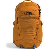
Daypacks & Packs
$86.93
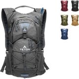
Hydration Packs
$47.99
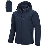
Packable Rain Jackets
$56.99